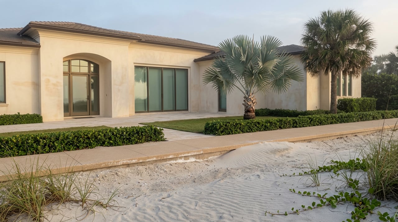
Walk the beach-walk at sunrise from Horizon House north toward Le Parc and your feet will tell you something your eyes might miss. The concrete under you rises and falls in a way that has nothing to do with the tide. Some stretches sit noticeably higher than others, a few feet of berm separating a dune-top path from a walkway that still runs closer to sea level. It is easy to read that as leftover storm damage. It is actually something more specific: three different sections of the same 1.2-mile walkway, rebuilt by three different groups of owners, on three different schedules, to three different heights.
That distinction matters more than it sounds like it should, especially this year.
One walkway, five boards, no single owner
The Promenade is not a city park amenity. It is private property, built by the Lutgert Company in the early 1970s as part of the original Park Shore master development, and it remains owned today by five separate Commons associations, each with its own board, each responsible for its own stretch of concrete, dune, and landscaping between Horizon House on the south end and Le Parc on the north. There is no single agency that decides when repairs happen or how high the next berm gets built. Five boards decide separately, which is exactly why the walk you're on right now does not feel uniform.
For more than fifty years that patchwork ownership barely mattered, because the walk itself barely changed. Hurricane Ian ended that in 2022. A 14-foot storm surge tore through the concrete in multiple sections, wiped out the dune vegetation, and destroyed the bollard lighting along most of the route. Almost four years later, the Gulf Shore Association of Condominiums reported this spring that most of the walk has been returned to its former condition. Most, not all, and not all in the same way.
The north end came back taller, on purpose
The three Commons associations covering the stretch from the Regent to Le Parc took the damage as a chance to rebuild higher rather than simply patch what Ian took. With permitting handled by coastal engineer Brett Moore of Humiston & Moore, who was retained to guide all five Commons through the City and Florida DEP process, that section went in atop a new 13.5-foot sand dune and berm, a meaningful jump from what existed before. The concrete work was slower than anyone wanted. Turtle-compliant lighting fixtures for that stretch needed City approval before installation could even begin, and once approved, the manufacturer hit production delays that pushed the final bollard lights out well past the walkway itself. But by the time that stretch was done, it was done at a height built for the next storm, not just for foot traffic.
The middle still sits at the old elevation
Here is the part that doesn't show up if you only look at whether the concrete is poured. The section fronting the Park Shore Association's own beach park, roughly the middle of the route, was restored to its original condition rather than rebuilt taller. As of the association's most recent progress report, its elevation sits at approximately six feet, well below what the northern Commons chose to build. A proposal under discussion would more than double that height by constructing a substantial new berm topped by the promenade, matching the elevated structure already in place to the north. According to that same update, PSA Board President Nancy Walkenhorst has been tracking the planning conversations directly with Commons representatives to keep the two efforts aligned. The case for doing it is not theoretical. During Hurricanes Helene and Milton in 2024, properties sitting behind the taller northern berm came through with far less damage than sections still at the older height.
As of the most recent update this spring, that middle-section elevation project remains a study, not a groundbreaking. It was never expected to be ready before 2026, and nothing reported since suggests that timeline moved up. So the stretch that looks the most finished, freshly repaved, replanted, benches back in place, is actually the one still carrying the pre-Ian risk profile.
The south end is still finishing, not starting over
The Commons covering the southern stretch near Horizon House, La Mer, and Gulfside took comparatively less structural damage from Ian than the north did, and their concrete repairs moved faster in the immediate aftermath. But finishing touches lagged behind the concrete. Replacement signage marking the walk as private, no bicycles, no dogs, no skating, was still being reinstalled Commons by Commons well into 2024, more than a year after the storm. And the most recent GSAC report is explicit that some work in the southern section is still outstanding, with completion expected sometime later this year. That's not a second recovery. It's the tail end of the first one, closing out roughly on schedule.
So walking the Promenade end to end right now means passing through three different stories at once:
- North (Regent to Le Parc): rebuilt taller, functionally done, engineered for the next surge
- Middle (fronting the PSA beach park): cosmetically restored, still at its original lower elevation, resilience upgrade still in the study phase
- South (Horizon House to La Mer/Gulfside): least structural damage originally, finishing work continuing into this year
None of that is visible from a quick look at the path. All of it is visible in how each section would hold up in the next named storm.
What's separate, and worth knowing anyway
The sand you're walking beside is its own project, run by the county rather than the Commons. A renourishment effort along the adjacent stretch of Gulf Shore Boulevard North aimed to restore the beach to its standard 85-foot width, and by the halfway point in early 2025 crews had placed more than 172,000 tons of sand toward that goal. Project manager Larry Humphries put the ambition plainly at the time:
"When we are done, Park Shore beach will be the only beach restored to pre-Ian condition in the whole County."
That's a different recovery, on a different timeline, run by a different entity than the five Commons boards. But it's happening on the same sand you're standing on, which is part of why the whole shoreline here has felt like a slow, layered rebuild rather than a single before-and-after.
Closer to home, the Park Shore Association's own February newsletter flagged beach park parking procedures and walkway improvements heading into this year's peak season, a reminder that even the access points feeding the Promenade are still being adjusted as the broader recovery continues.
What to watch for the rest of this year
If the middle section's elevation study moves from planning into an actual construction timeline before the end of 2026, that will be the biggest physical change to the walk since the north end's berm went in. Until then, the honest way to think about the Promenade is not "repaired" or "not repaired." It's three sections at three different points in a recovery that started with the same storm and hasn't finished on the same schedule anywhere along the route.
Next time you're out there, notice where your feet rise and where they don't. That's not random. That's five boards, three timelines, and one very specific gap in the middle still waiting on a decision.
If you're curious how these kinds of neighborhood-specific details factor into what a Park Shore property is really worth today, or want a broker who tracks the block-by-block particulars rather than just the median, Mark Paige Riley is glad to talk it through. Let's Connect.